CARTOGRAPHY
Illustrated maps provide a playful and engaging way to tell the stories of the places they represent, balancing whimsy and way-finding functionality. My maps have been used for music festivals, public programs, academic projects, personal mementos and more.
I also do custom illustrated maps, a perfect gift for a birthday, anniversary, or move.
Check out some of my past map work and contact me to talk cartography for your next project!
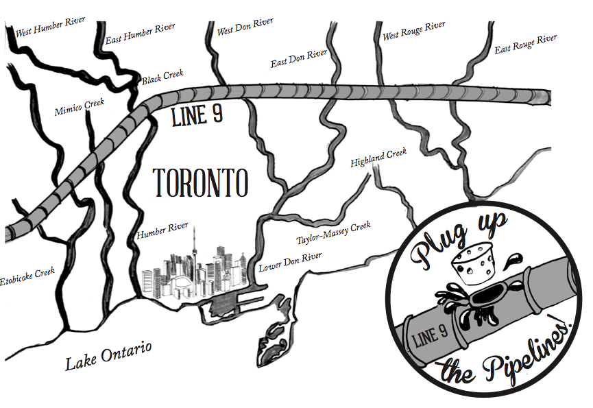
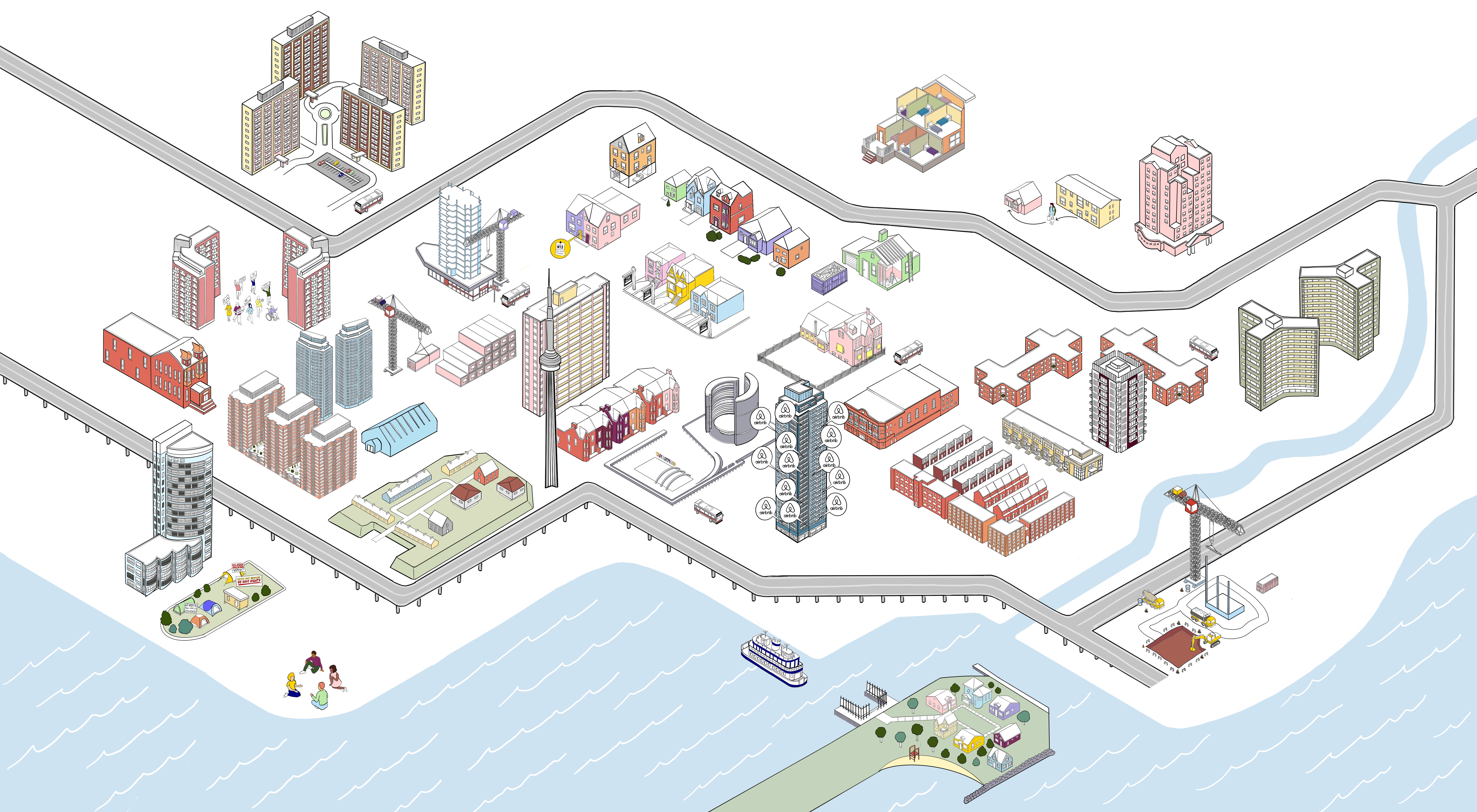
ENCAMPMENT SUPPORT NETWORK
The Housing Crisis is a Real Estate Game
I worked with the Encampment Support Network’s “explainers committee” to develop an interactive map demonstrating how the so-called housing crisis is the result of a web of interconnected policies and deeply embedded societal values prioritizing real estate and private property over the wellbeing of all.


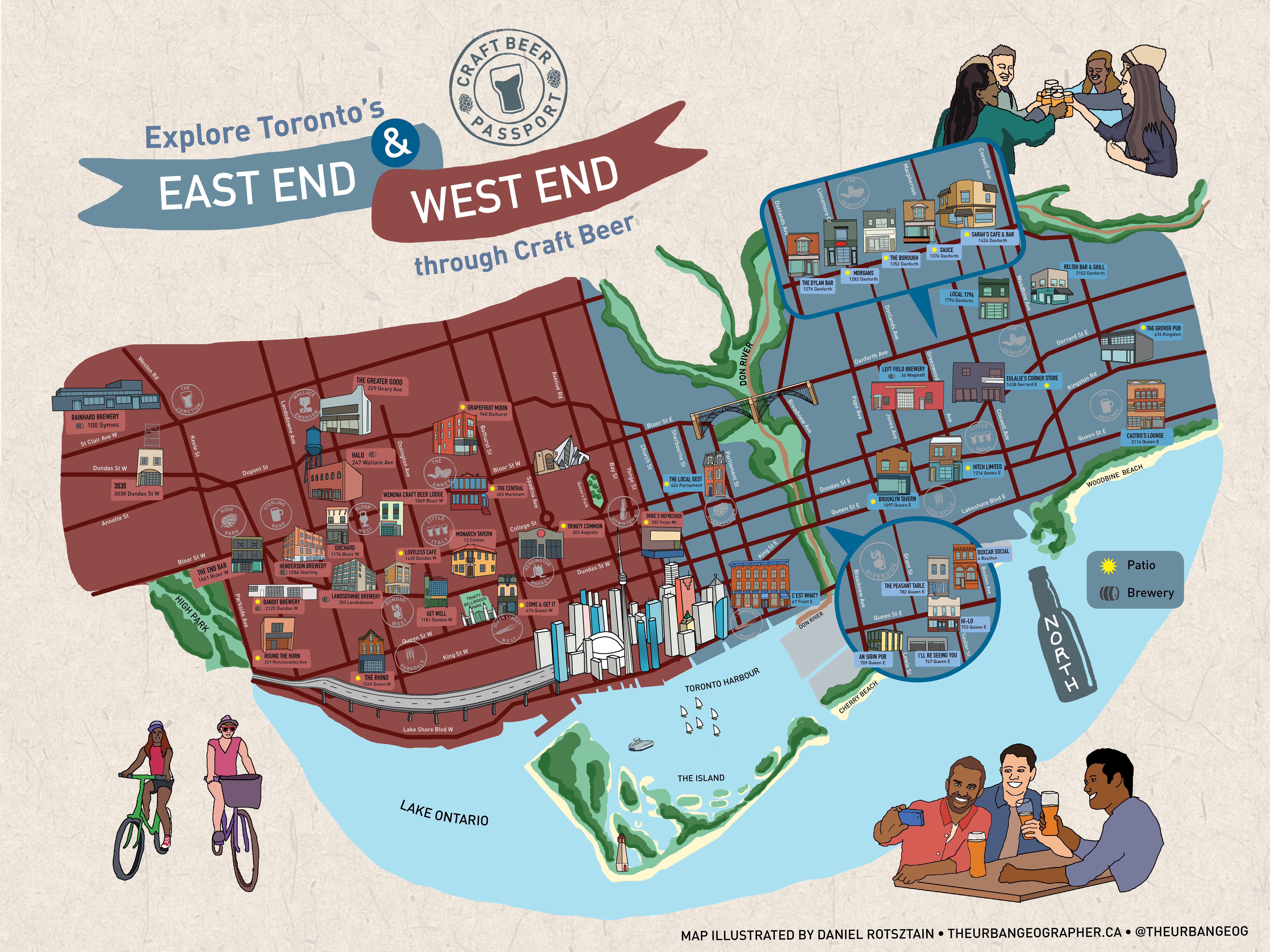
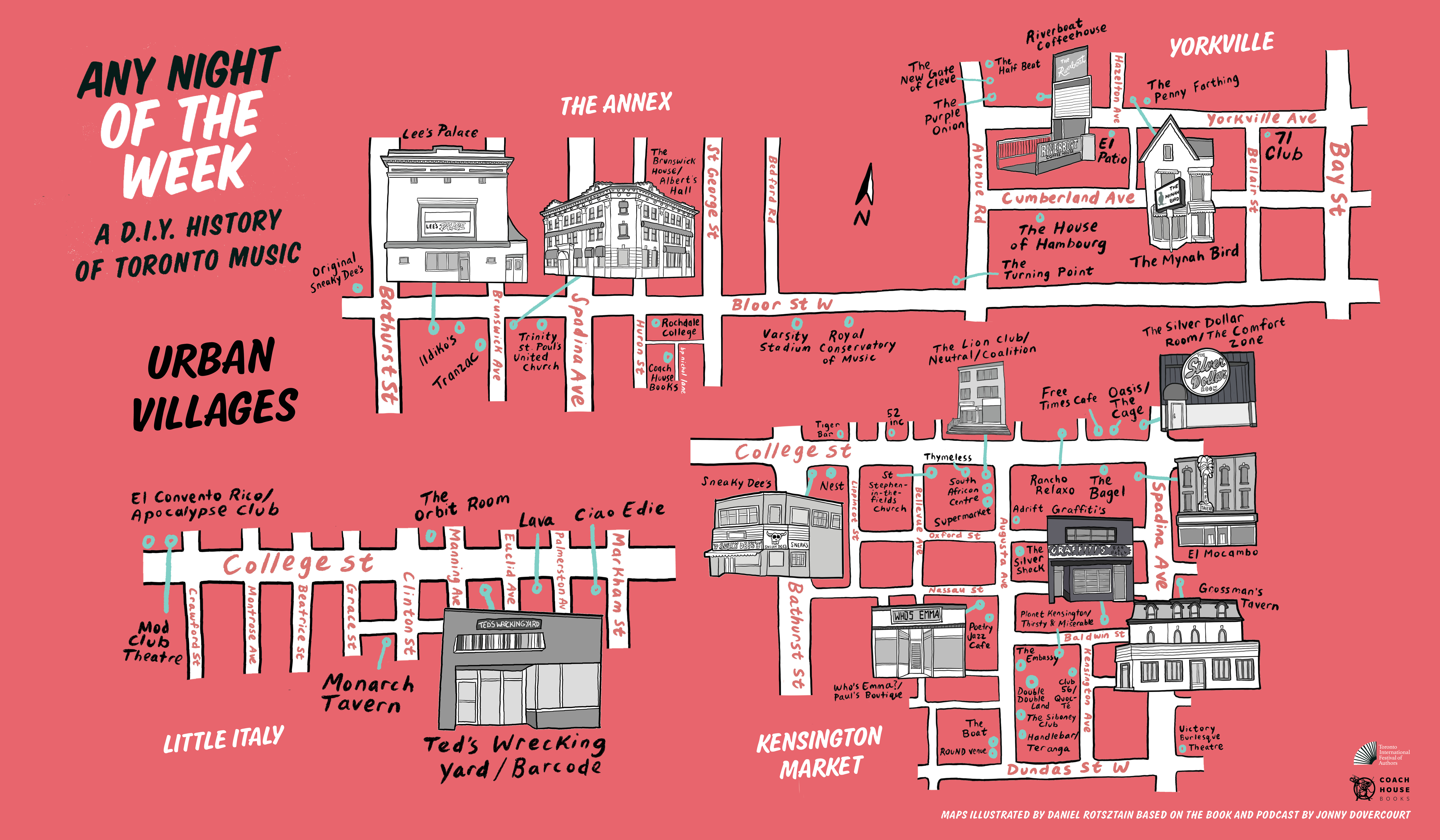
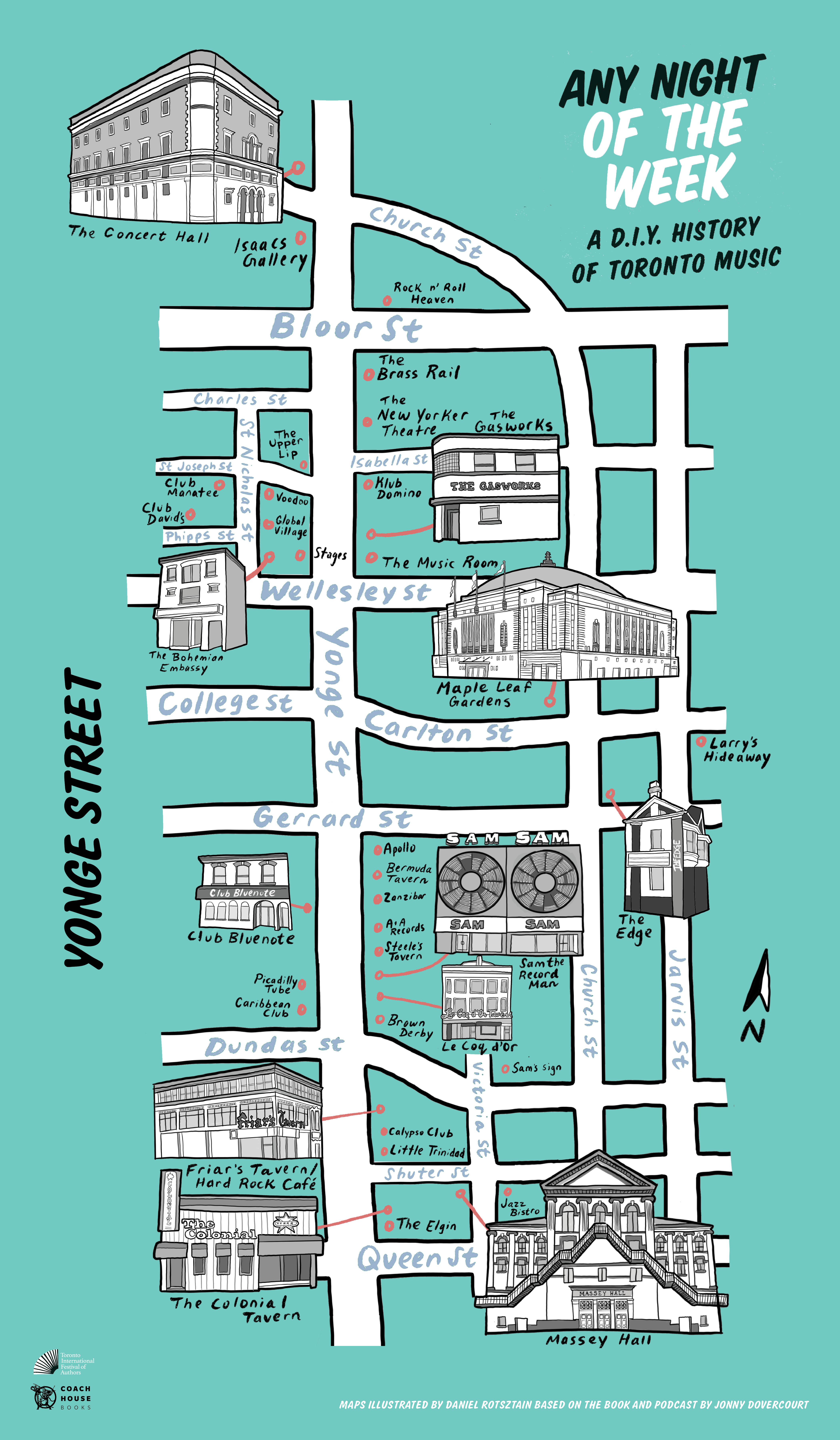
COACH HOUSE BOOKS
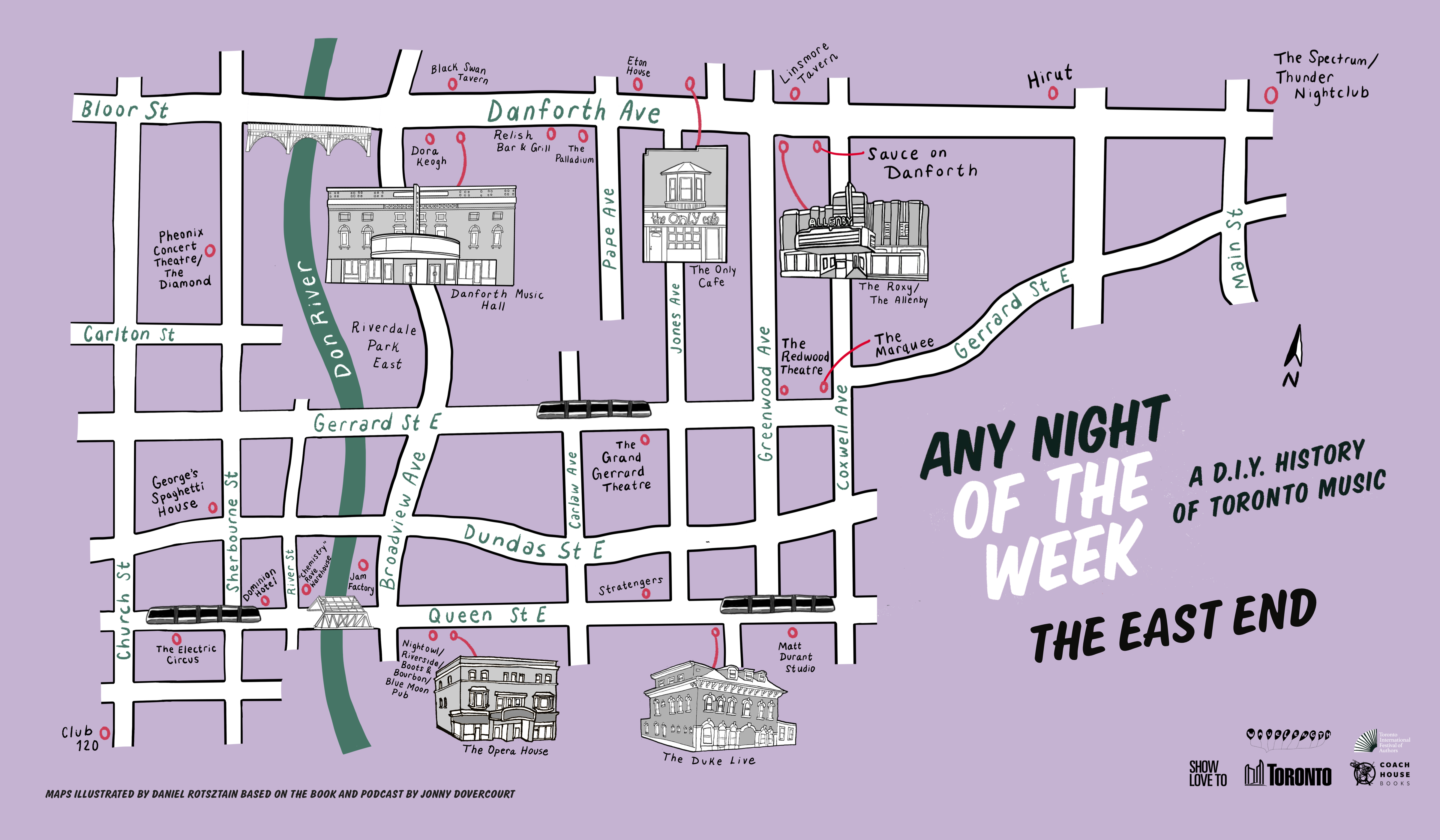
Any Night of the Week Maps
These maps were illustrated to accompany Jonny Dovercourt’s ode to Toronto music history, Any Night of the Week published by Coach House Books, and a podcast series of the same name. The book documents Toronto's music scene with its Yonge Street origins and its gradual move west (maps 1 to 3) while the podcast explores music’s role in neighbourhoods across the city (maps 3 to 6). The venues included span from legendary to almost forgotten, but all contributed to the city we know and love today.


THE WEST END PHEONIX
Story Maps
For the West End Pheonix, I have contributed maps as part of features exploring beloved bus routes and the persistance of Toronto’s DIY music scene despite the hardships of rising rents.


THE GRIND MAGAZINE
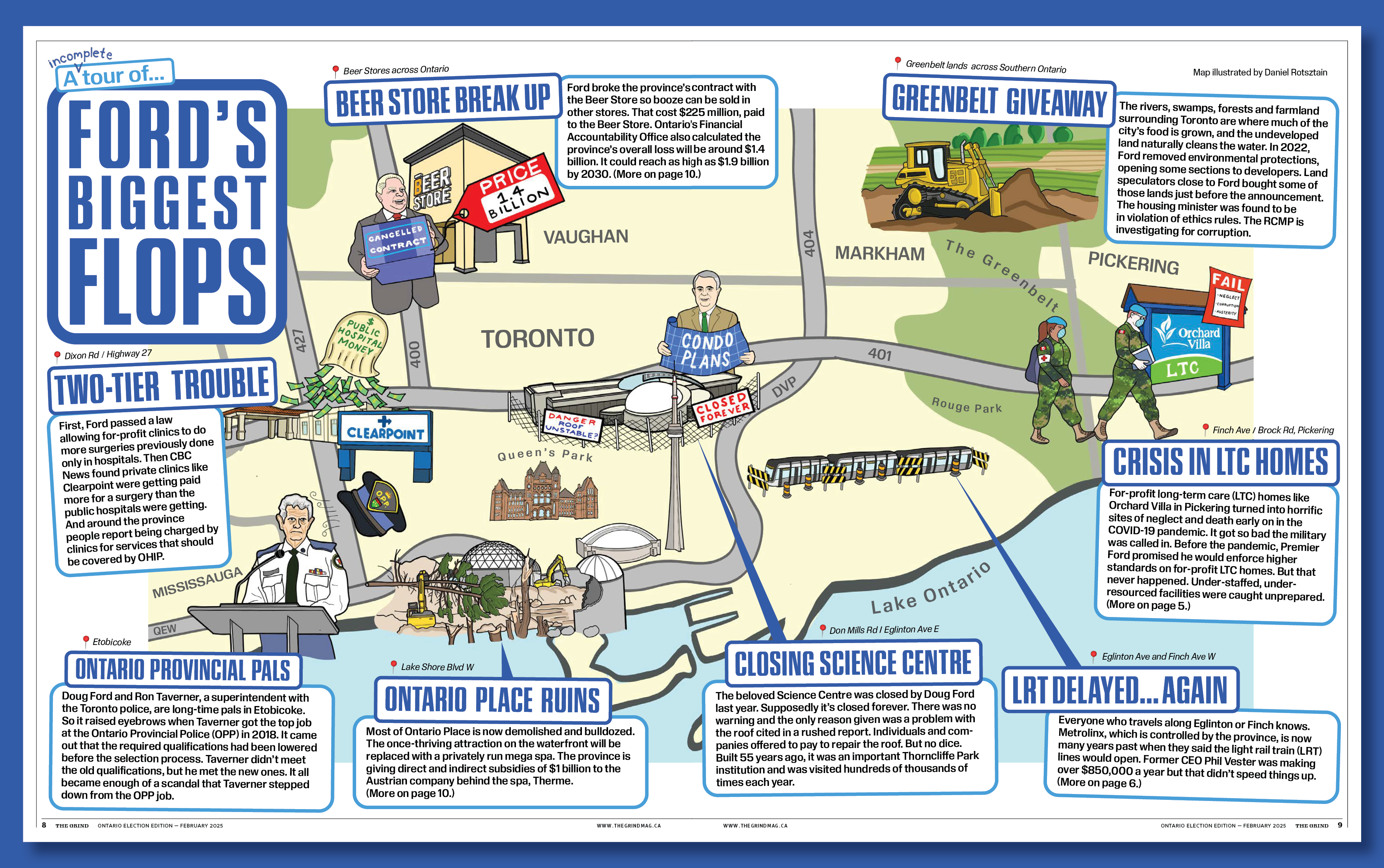
Ford’s Biggest Flops
For the Grind Magazine’s 2025 provincial election issue, I mapped an (incomplete) list of Doug Ford’s biggest flops, spatializing the endless incompetence, corruption, kick backs, delays, preferential treatments, and straight up evil that has characterized Ontario politics since 2018.
UMA NOTA CULTURE
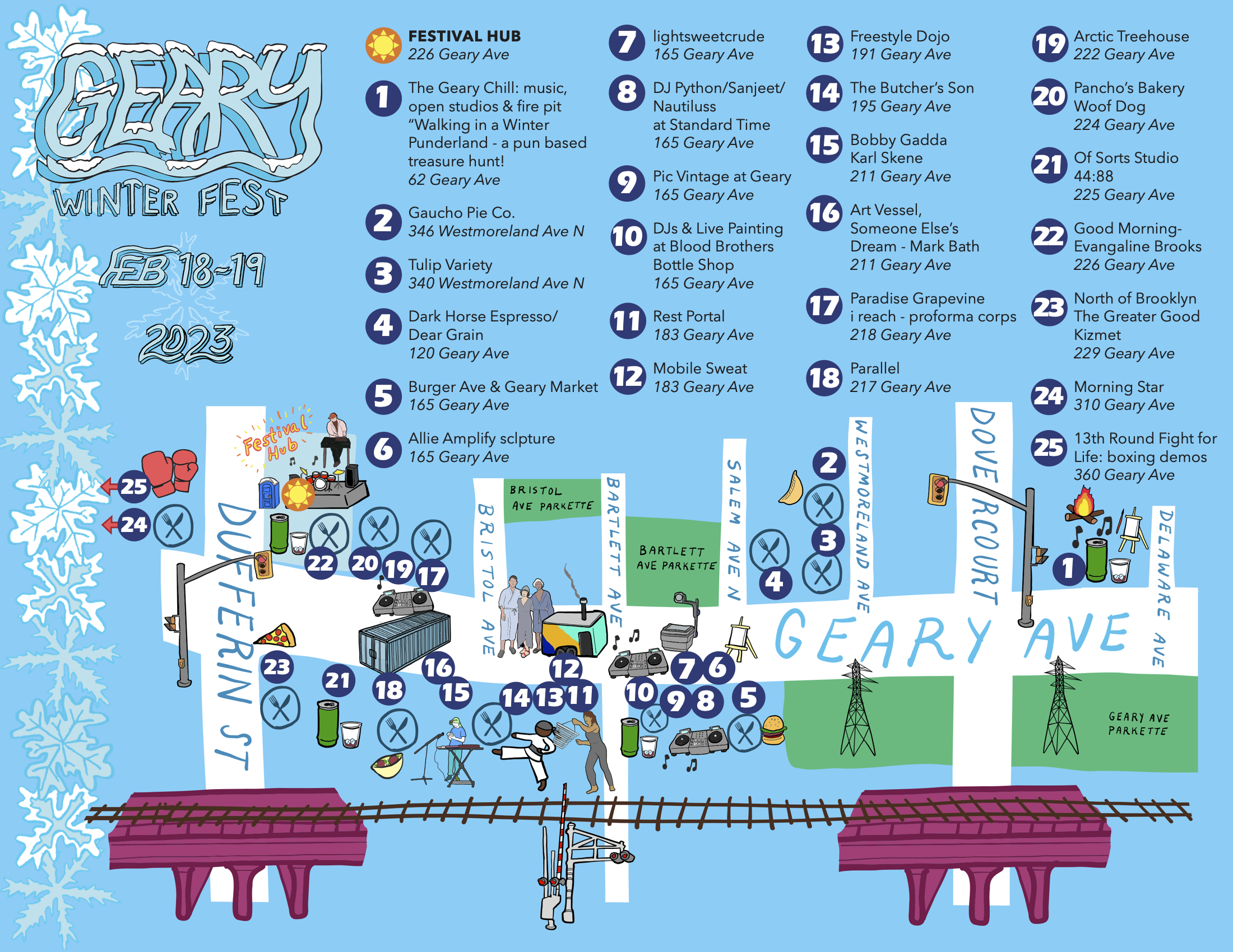
Geary Art Crawl Maps
This map for was illustrated for 2022 edition of the Geary Art Crawl and its 2023 winter counter part. In 2022, the brilliant team at Uma Nota Culture packed over 30 art activations and more than 7 music zones featuring performances by the best of independent Toronto musicians.


PARKDALE COMMUNITY LAND TRUST
Parkdale Tower Rental Housing Study Maps
This map commissioned by the Parkdale Neighbourhood Land Trust highlights buildings included in its 2022 report, Parkdale Tower Rental Housing Study, an eight-month community-based action research project on the impact of financialization and gentrification on Parkdale’s rental towers on housing affordability and tenant wellbeing.
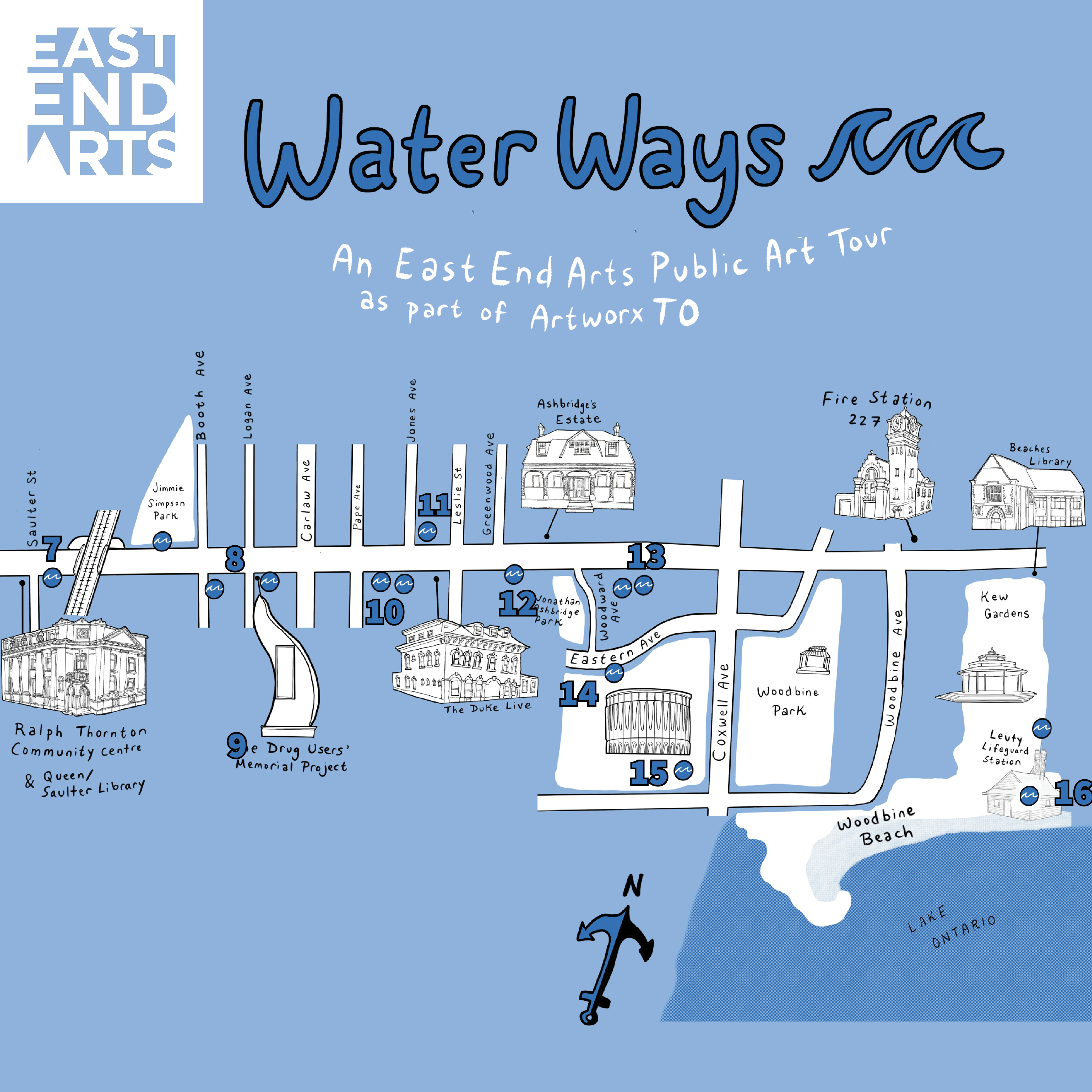
SCARBOROUGH ARTS
ArtworxTO Local Tour Maps
A series of maps illustrated for Scarborough Arts to celebrate Toronto’s Year of Public Art. The maps were developed in collaboration with Howard Tam of Eat More Scarborough and the Tamil Archive Project, and were accompanied with delicious food tours throughout the summers of 2021 and 2022.


EVERGREEN BRICK WORKS
In which we draw a people’s map of the Don River
A map for Mare Liberum’s ongoing Evergreen Brick Works project investigating the histories and geographies of the Wonscontonach/Don River. Each illustration on the map corresponds to an episode of Don River Radio, hosted by Dylan Gauthier.
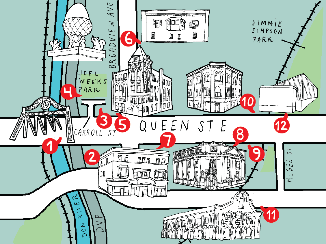
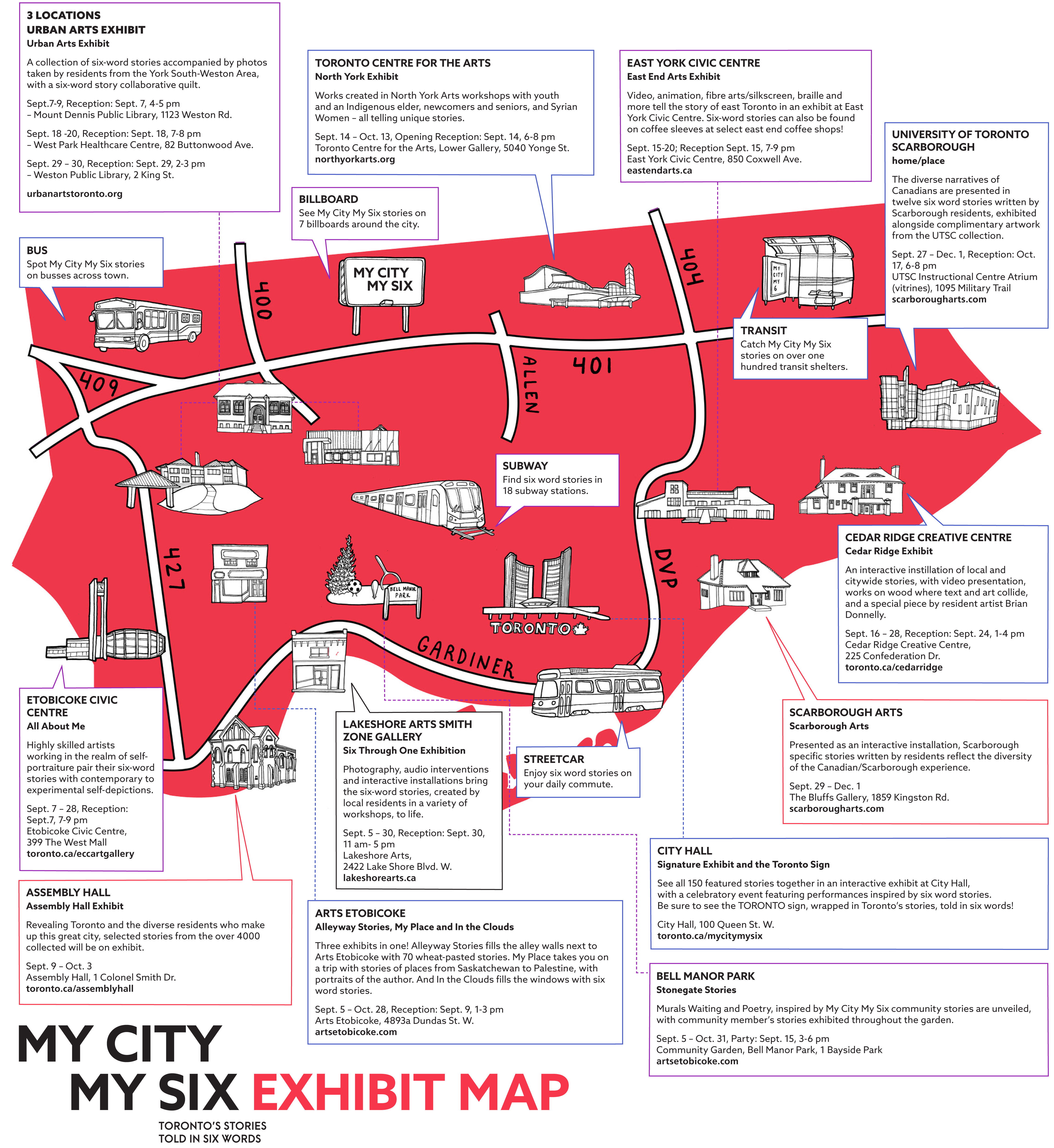
CITY OF TORONTO
Cultural Loops Guide
For the City of Toronto’s Cultural Hotspots initiative, I illustrated maps for the North York Cultural Loops Guide (2016), the East Toronto Cultural Loops Guide (2018), and the York Cultural Loops Guide (2019) (maps 1 to 4). The guides encourage Torontonians to explore the ecology, history and culture of neighbourhoods outside the downtown core. Building off this initiative, the City of Toronto’s My City My 6 project was a series of resident-submitted six word poems evoking the feeling of life in Toronto, with exhibits across the city illustrated in map 5.


CARTOGRAMS
Reimagining Geographies
While we navigate with apps like Google Maps to go as quickly as possible from point A to point B, the way we conceive of space is more subjective and emotional, placing more emphasis on places we know and have connections and exaggerating them in our conception of space.
These maps attempt to express that subjective scale, closer to how we actually experience and navigate place.
![Southern Ontario’s physical geography is often derided as flat and boring, ignored behind 400-series superhighways and big box plazas. Beyond the highways, the landscape is dramatic! This map is an effort to re-assert these three cities’ beautiful landscapes into our geographic conscience.]()
![Every street has a own story. These maps are a celebration of the history, architecture and culture of a street, as told through its local landmarks and unique buildings. Here's Alice Street in Guelph, Ontario]()
![The landmarks of Woodlawn Road in Guelph, Ontario]()
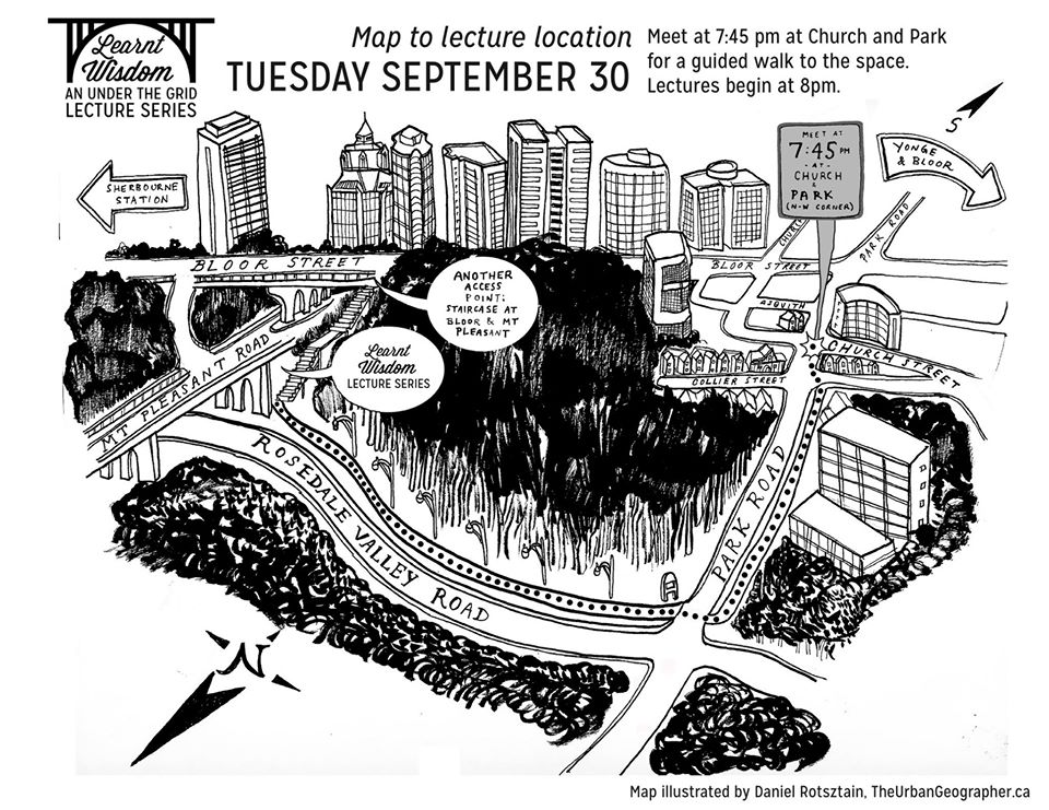
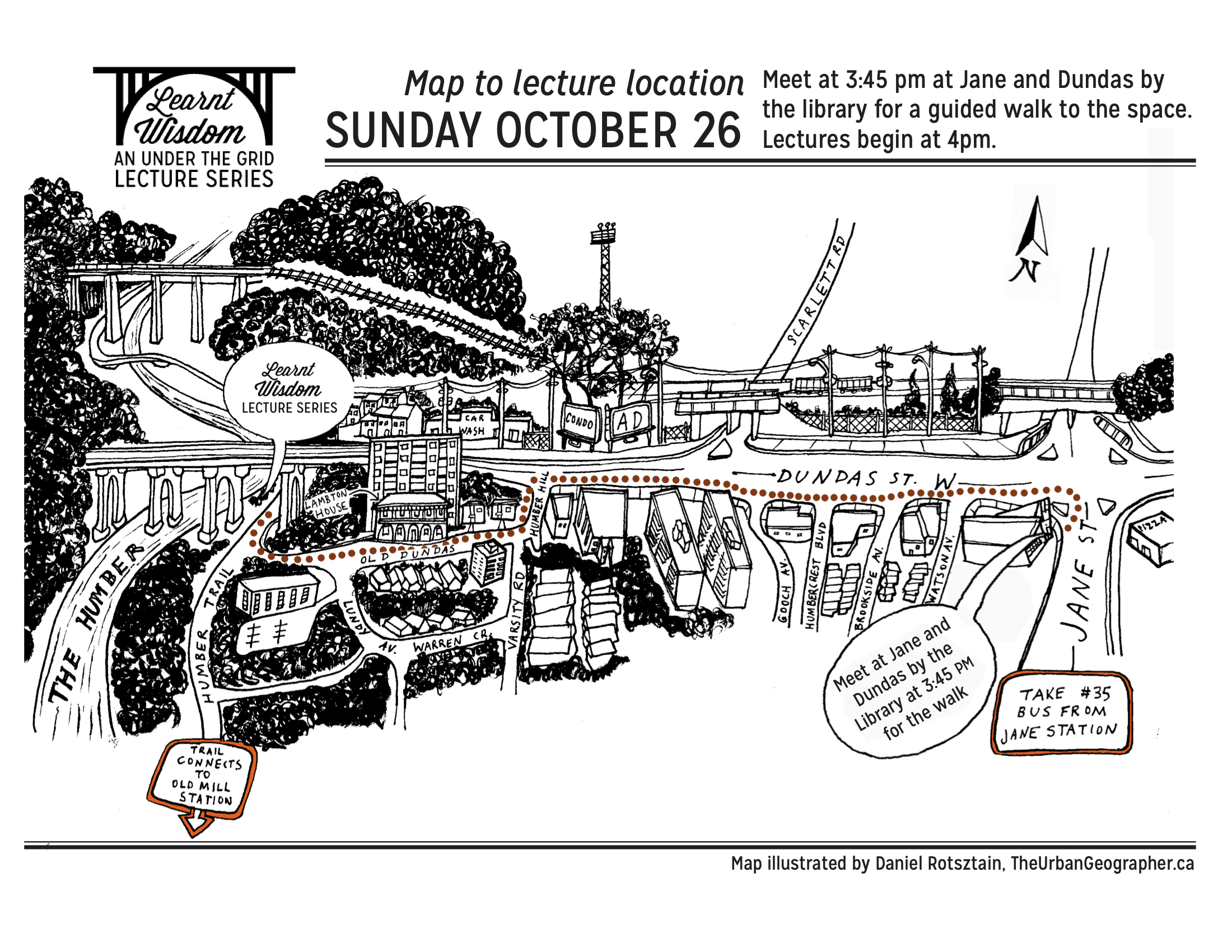
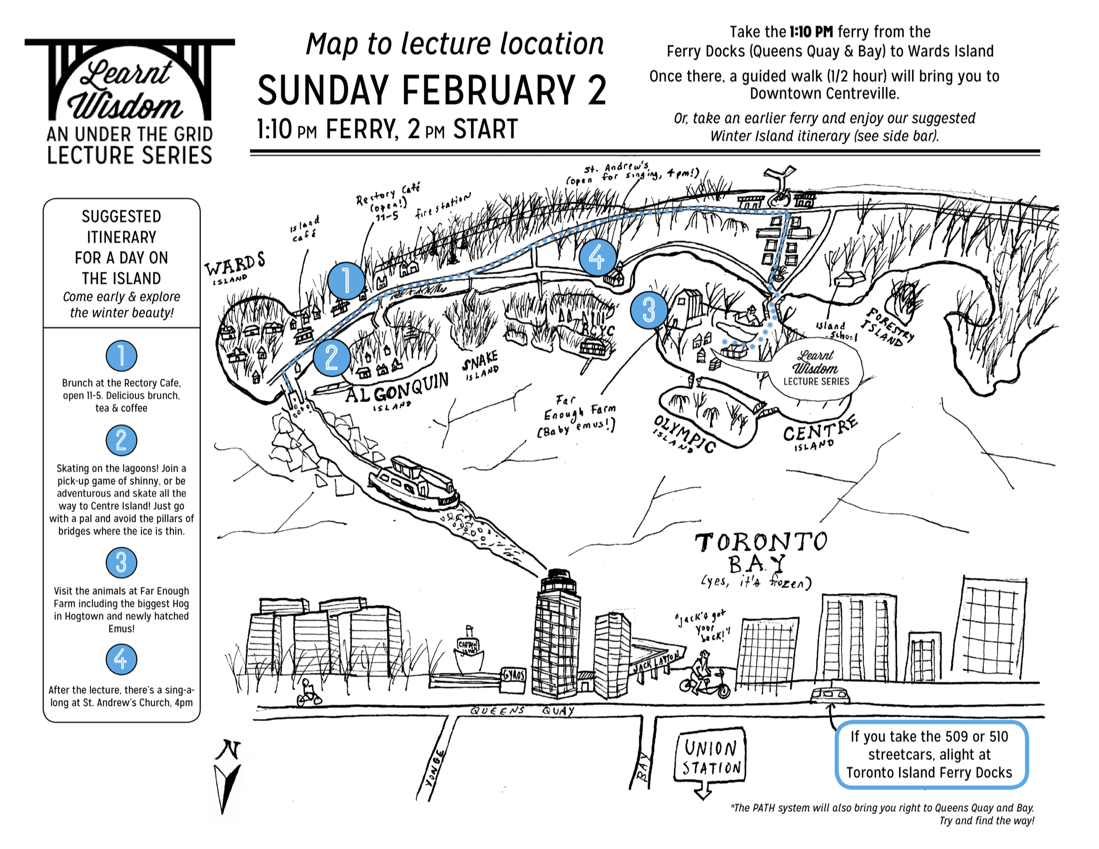
LEARNT WISDOM LECTURE SERIES
Lecture Route Maps
For the Learnt Wisdom Lecture Series, a story-telling meets urban exploration series, illustrated maps accompanied each event to guide guests from a designated meet up to the event space, held in overlooked and neglected spaces throughout Toronto. 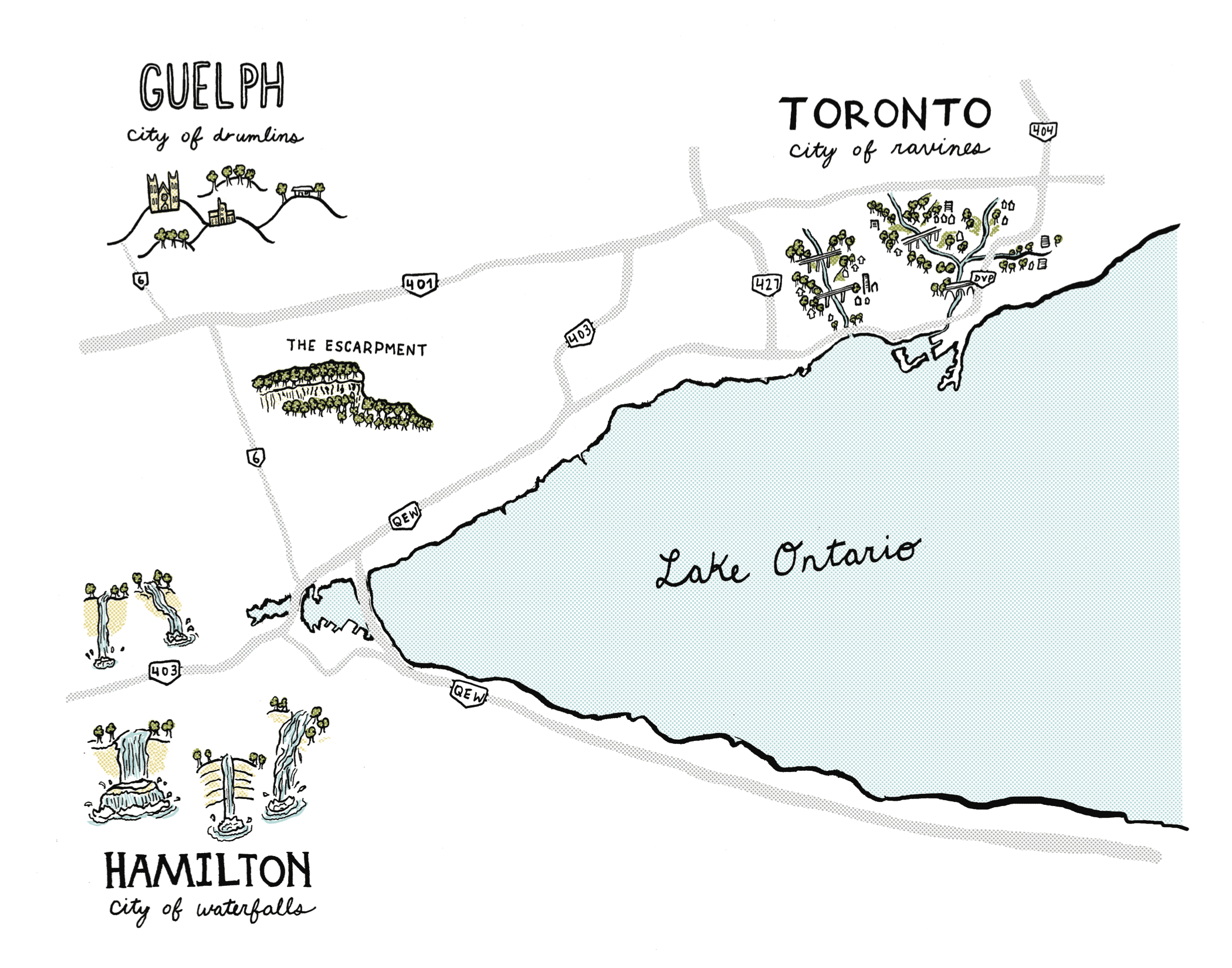


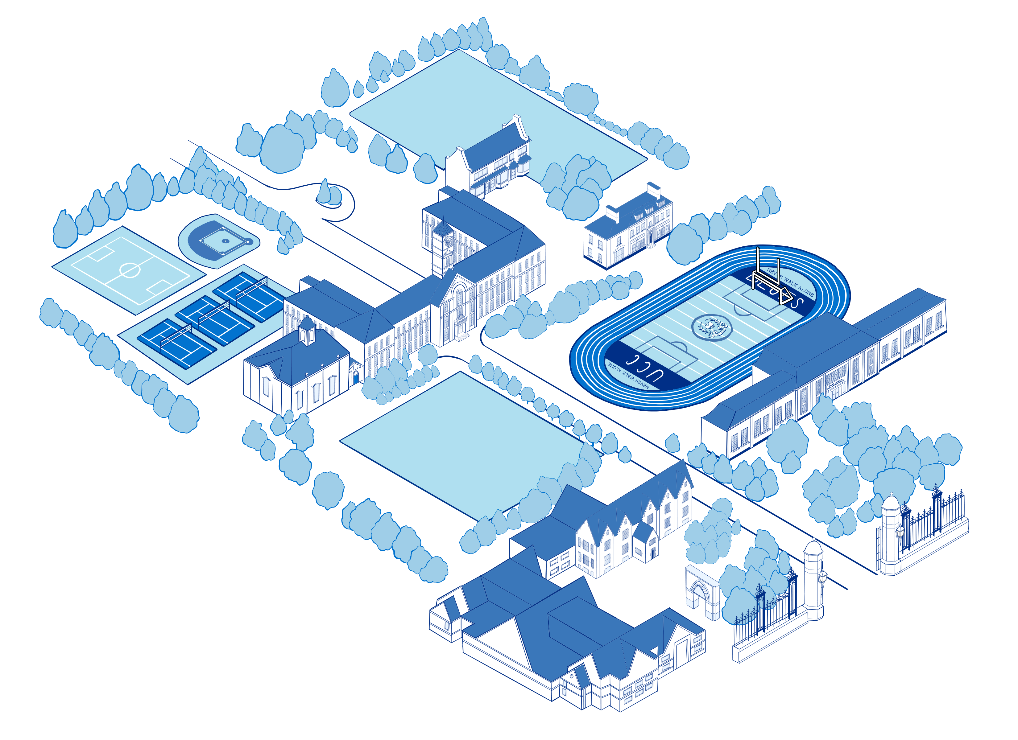
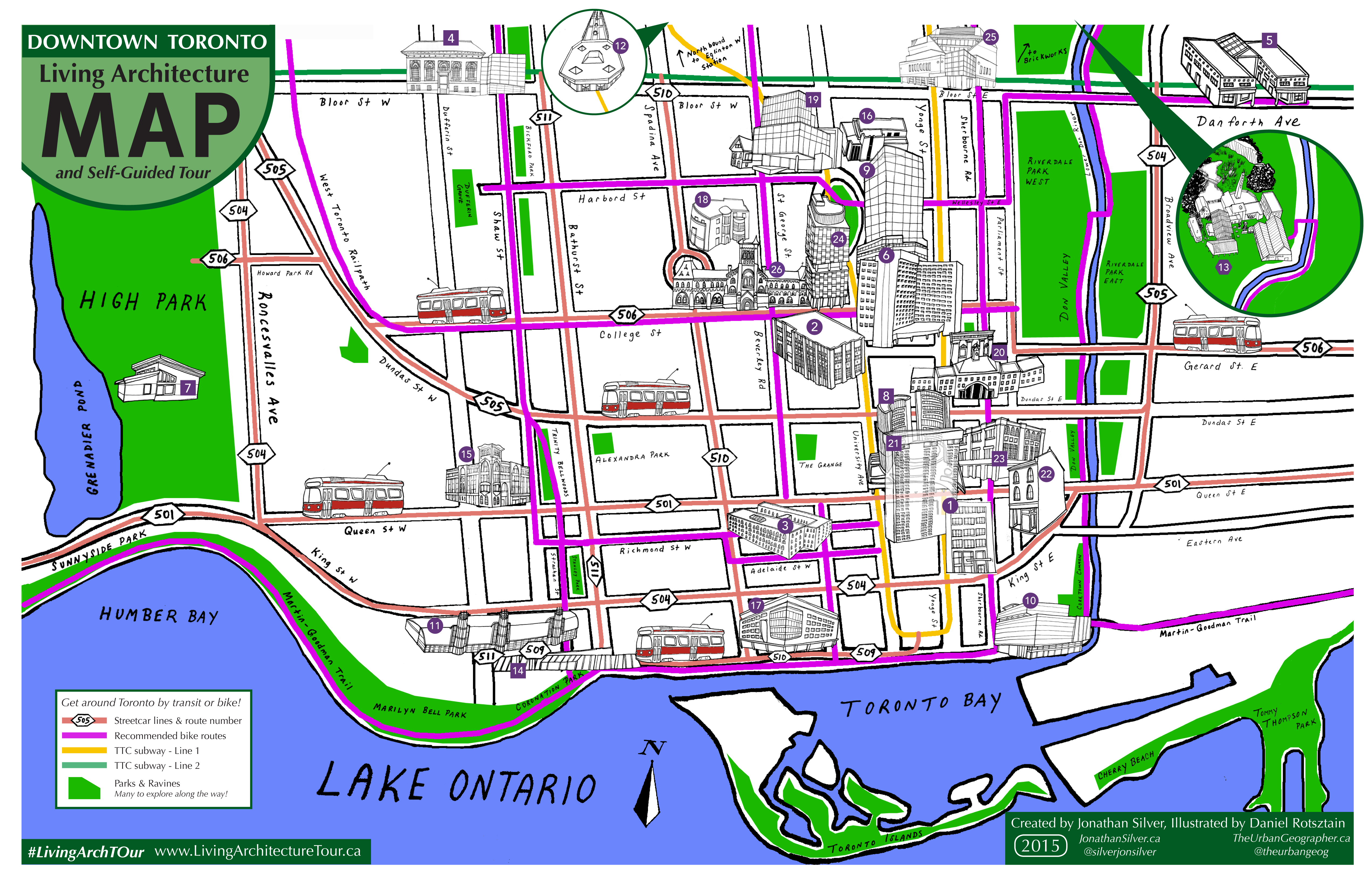
VARIOUS
A selection of illustrated maps
Want to see more? Here’s a few more of my illustrated maps that demonstrate the range of style and application possible with cartography.